
Posted by Horus Vision on Jul 31st 2026
You spot a bull elk across a timbered draw.
You range him at 650 yards.
You take the shot.
You think you see the impact, but the bull disappears into the trees.
You know where he was standing. But after dropping into the canyon and climbing the other side, the terrain looks completely different.
We all know that feeling where the tree line you used as a reference is hard to pick out. That rock you thought was distinctive suddenly looks like every other rock. It's getting dark and you’re losing confidence that you’re in the right place.
This is where having precise waypoints in onX Hunt can be a lifesaver.
The onX Hunt App is a powerful tool for hunters to plan their hunts, clearly view property boundaries, navigate in the field, and place precise waypoints for faster animal recovery.
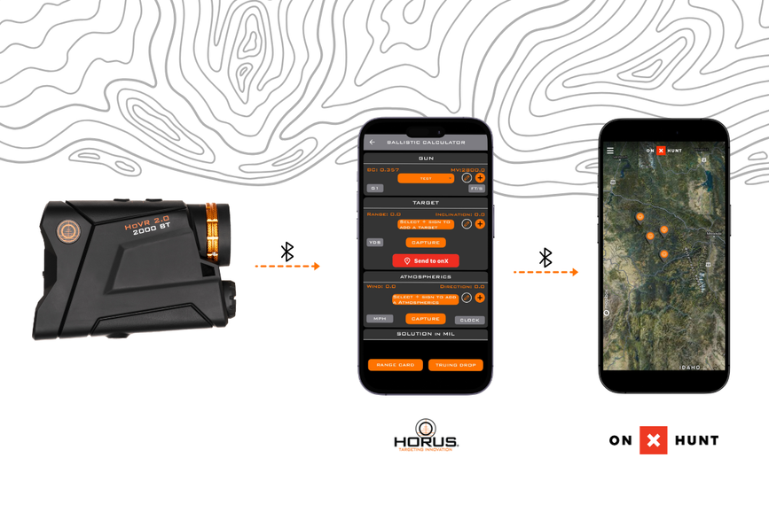
Horus provides the range data and firing solution, then places a precise waypoint on the onX map once you’ve taken your shot and are ready to navigate to the downed animal.
Where Is the Bull?
To reach the Bull you want to get to the last place you saw him as quickly as possible.
Range It. Mark It. Recover It
With the HoVR® 2.0 BT Laser Rangefinder, you can send your range data directly to the Horus Ballistics App via Bluetooth®, get a fast and accurate firing solution, and take your shot. The combination of precise range data and the US Military validated ballistics solver can give you confidence in your shot.
Once you’ve taken your shot you can drop your shot location as a waypoint into onX for a quick and efficient recovery.
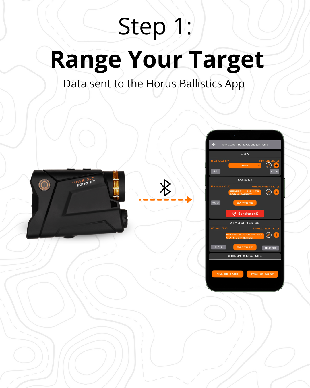
Step 1: Range Your Target
Use the HoVR 2.0 BT Laser Rangefinder to range your target. (Tip: Every Horus product purchase includes a 90-day trial of onX Premium to get you started).
When the rangefinder is connected to the Horus Ballistics App via Bluetooth, the range and inclination information are instantly sent directly to the app.
No writing down numbers. No manually entering the data when time is critical to get your shot off before the bull moves. Just an extremely fast and precise solution so you can get an accurate shot off quickly.
IMPORTANT: You need to either have your phone pointed in the direction you are ranging or manually enter the direction of fire into your ballistics calculator to ensure your waypoint pins to the correct location in onX.
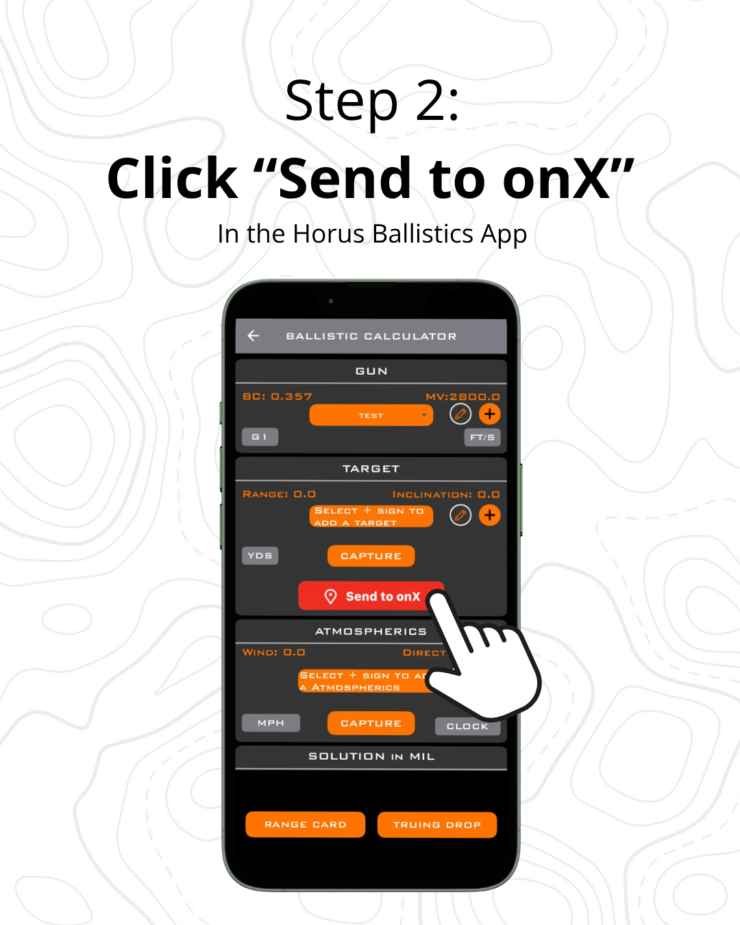
Step 2: Tap "Send to onX"
Once you've taken your shot and are ready to begin the recovery, you select the ranged target (ensuring the correct direction of fire) in the Horus Ballistics App and just tap "Send to onX."
The app sends the location information associated with the ranged target directly to onX Hunt.
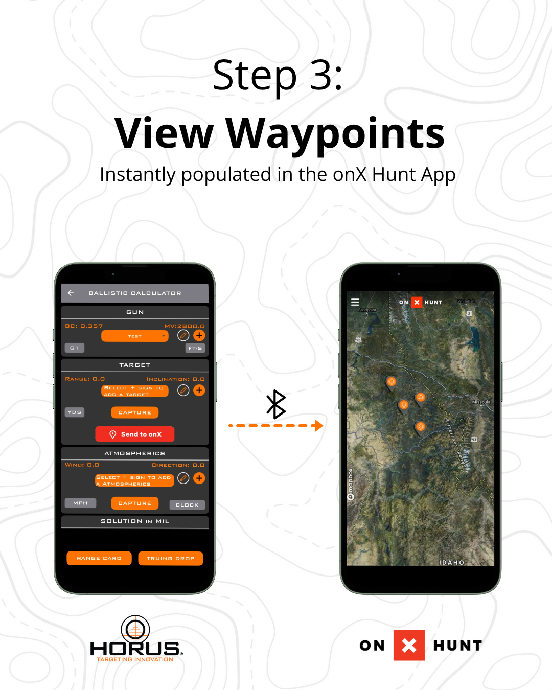
Step 3: View Your Waypoint
The onX Hunt App will open automatically with the waypoint already placed on the map.
From there, you can save it, rename it, navigate to it, or use it as part of your larger hunt plan.
The entire process takes only a few seconds.
How Am I Getting to Him?
Now you know exactly where you last saw the bull..
The next question is how you're going to reach him.
This is where your onX map is a great planning tool. If you don’t have an integrated HoVR 2.0 Laser Rangefinder sending waypoints to your onXHunt App, you can still manually enter a target and get a quick ballistics solution and then send a waypoint to onX.
Look at the terrain between you and the bull. Check the elevation, drainages, ridges, trails and other terrain features that could affect your route.
The straight-line distance might be 650 yards but we all know the actual route is likely much longer but onX will help you plan and navigate the safest and most efficient route. Maybe the most direct route means dropping hundreds of feet into a drainage and climbing right back out. Another route might add distance but keep you on a more manageable terrain.
Use the map to figure out which route makes the most sense before you start moving then use the Compass Mode to precisely navigate to your waypoint without wasting extra time or energy.
Hunt Together, Even When You're Apart
If you're hunting with a group, everyone doesn't have to take the same route.
One person might work around the ridge while another comes up the drainage. Someone else might already be closer to the animal.
With onX, you can share locations and see where your hunting partners are, where they've been and what they've marked along the way.
That makes it easier to coordinate the approach.
You can mark the bull's location, share your position and communicate where everyone should meet up. Instead of trying to explain your location over the radio, everyone can work from the same map.
You know where the animal is. You know where your partners are. You can now make a plan for the safest and most efficient recovery and pack out.
Use the Waypoint to Stay Oriented
Remember that waypoint you created when you ranged the bull?
It can help keep you oriented as you move. Leverage the onX Compass Mode to stay on track while you’re burning daylight.
As you cross a drainage, climb a ridge or move through thick timber, you can check your position against the waypoint and make sure you're still heading toward the right area.
That can make a big difference when the terrain starts to look unfamiliar or daylight is fading.
How Am I Getting Him Out?
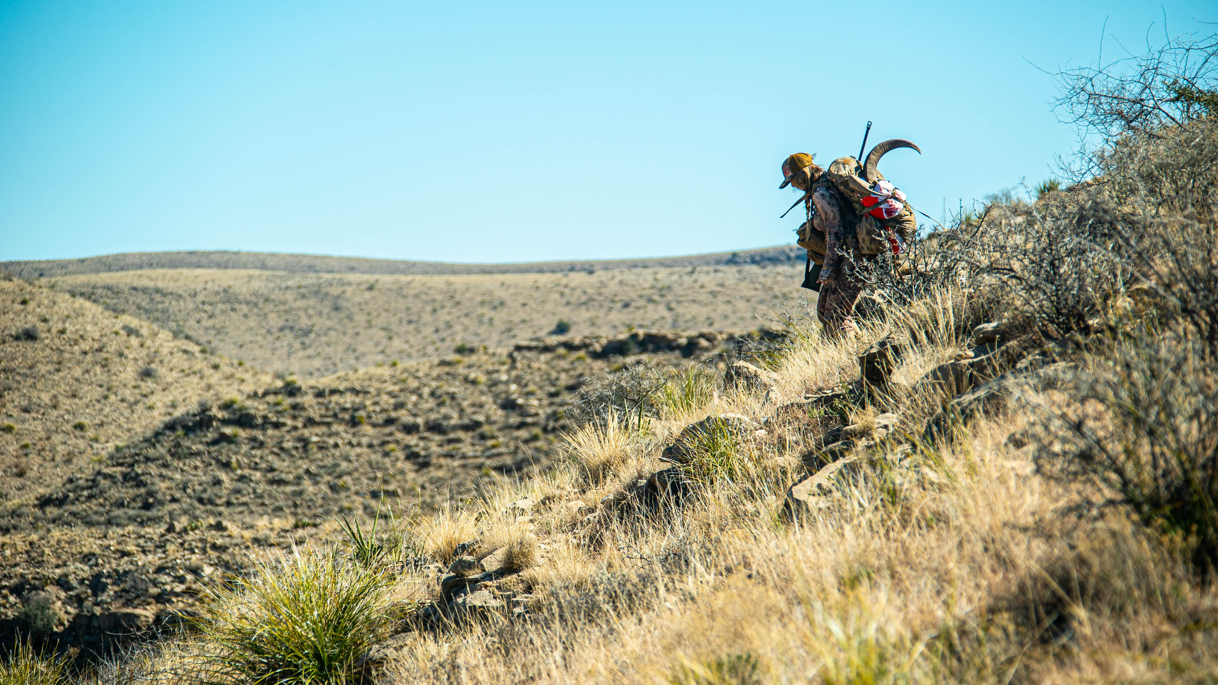
Congrats! You reached your waypoint pin, followed the trail and found the bull.
You made the shot.
Now you need to get him out.
Plan Your Exit Path
Now that you’ve located the bull, you can use the onX Map to optimize your pack out path.
You have an animal, your gear and potentially several trips of meat to carry out.
Take a few minutes to look at the map. Using onX Hunt’s Route Builder feature, you can plan your route to get to the nearest trail for a simpler packout, or switch to freeform mode to plot your own path back.
Check the terrain, elevation, trails and distance. Look for a route that makes the recovery easier, even if it means taking a different way back.
Map the route before you start the pack-out to save time and energy.
Once you find the right route, the real work begins.
Have Confidence in Your Hunt
The real power of the onX Hunt + Horus integration isn't just knowing where the bull was when you pulled the trigger. It comes from the confidence of always knowing where you are, where you're heading, and that you’re optimizing your route.
Because when the light fades and the landmark you thought you'd remember suddenly disappears, you have something you can rely on. Have confidence in your shot with the Horus Ballistics App and confidence in your navigation and recovery with onX Hunt.
You have a system.